Easiest from Cozihaus on Blodgett Lake
Signature picks · Hatcher Pass Hiking
Reed Lakes Trail
A genuine alpine hike above Hatcher Pass: mountain scenery, a rock and boulder section, and alpine lakes at the end — rewarding even if you turn around before finishing the whole route.
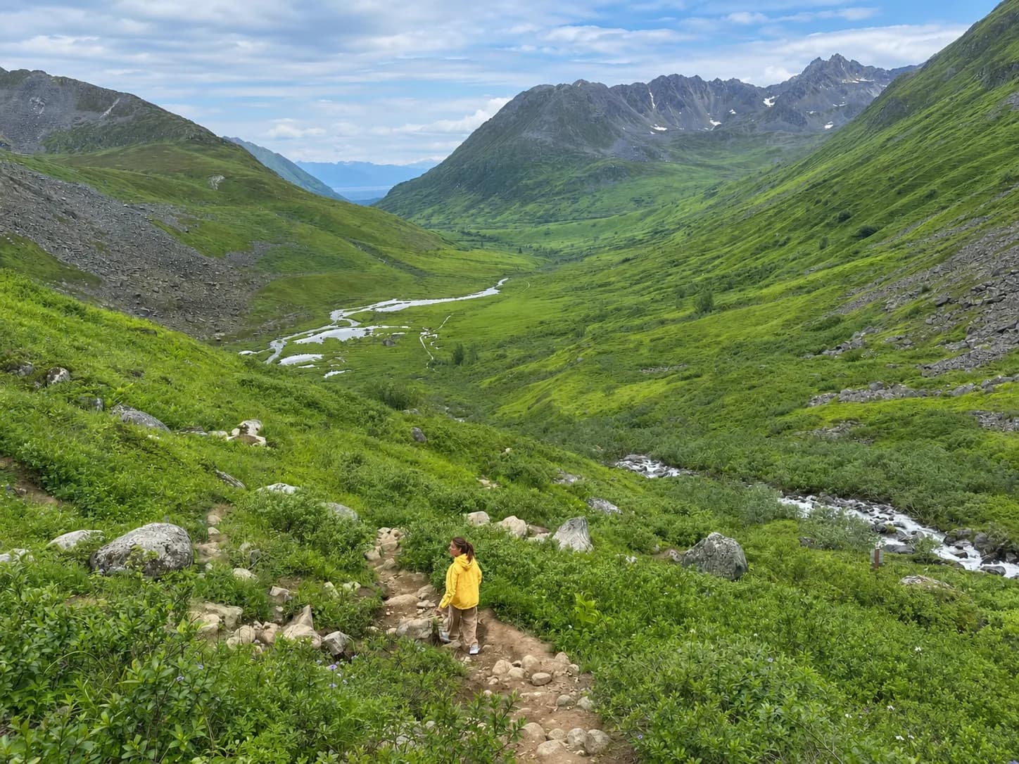
How far do you want to go?
- Short tasteAbout 1-2 hoursWalk the approach and turn around whenever the terrain or your time runs out — still real alpine scenery, no boulder section required.
- Valley outingAbout 3-4 hoursReach well into the boulder section and alpine terrain without committing to the full route to the lakes themselves.
- Full routeMost of a dayThe complete hike to Reed Lakes and back, with real elevation gain and the boulder section throughout — the significant hike this guide is written for.
Who this suits
Guests who want a significant, active hike in the Hatcher Pass area and are comfortable with boulder terrain and real elevation gain. For an easier Hatcher Pass day, see our Hatcher Pass & Independence Mine guide instead.
A plan that works
- Set expectations as a significant hike, not a stroll — alpine terrain, a rock and boulder section, and meaningful elevation gain on the full route.
- This is genuinely flexible: a short taste from the trailhead, a longer valley outing into the boulder section, or the full route to the lakes are all real, worthwhile versions of this hike — you do not have to reach the lakes to have a great time.
- Prior working figures put the full round trip at roughly 8 and a half miles with real elevation gain — worth checking current numbers before you commit to the whole route.
- Check current Archangel Road and trail conditions before you go — access to the trailhead can itself be the limiting factor.
Plan your visit
Check current Archangel Road and trailhead access conditions before you go.
Drive and timing, honestly
- No drive time is stated from either property — none has been measured.
- The drive into Hatcher Pass and the trailhead approach are the same regardless of how far you go once you're on foot — see the flexible on-site time breakdown below for what actually varies.
What we won’t promise
- We cannot promise ordinary passenger-vehicle access to Archangel Road or the trailhead — worth checking current conditions.
- We would not treat the roughly 8.5-mile, ~2,000-foot figures as confirmed official numbers — they're prior working figures.
- We cannot promise trail conditions, snow-free dates, or weather.
- We would not call this an easy or short hike.
Practical notes
- Pack real hiking layers and footwear — the boulder section and alpine exposure are real.
- This pairs with the rest of a Hatcher Pass day, including Independence Mine, if you want to make it a bigger trip.
Local context
Around Hatcher Pass
Where Reed Lakes Trail sits within Hatcher Pass — open any of the mapped places directly, or explore more of the area below.
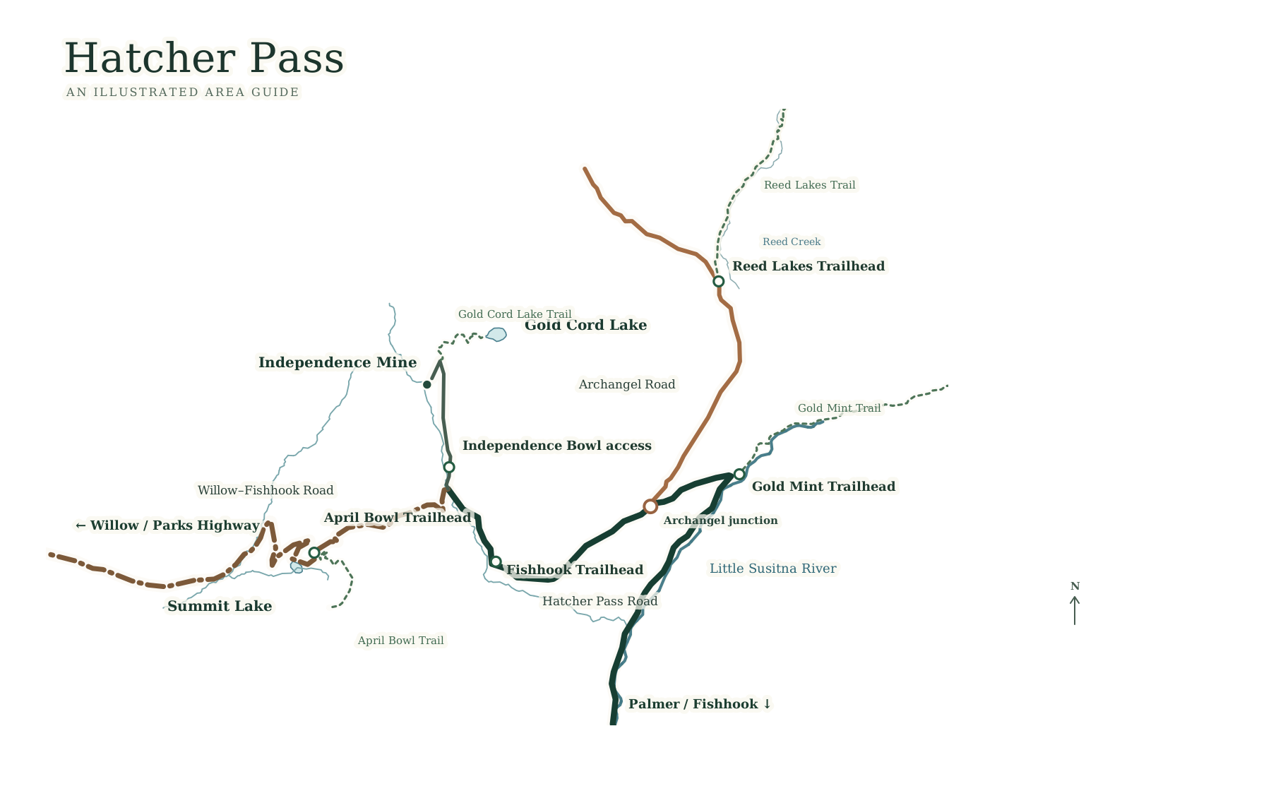
Choose a place to view on the map
Explore Hatcher Pass experiences
- Reed Lakes Trailstrenuous · Flexible: one hour to a full day
- Summit Lake at Hatcher Passeasy · A short, easy stop within a Hatcher Pass day
- April Bowlmoderate · A few hours · a real hike, not a casual stop
- Skeetawk Ski AreaFlexible · a winter ski stop or a summer café/trail stop
- Gold Cord Lakemoderate · 1 to 2 hours · short alpine payoff
- Gold Mint Trailstrenuous · Flexible · any point is a legitimate turnaround