Easiest from Cozihaus on Blodgett Lake
Strong options · Hatcher Pass Hiking
April Bowl
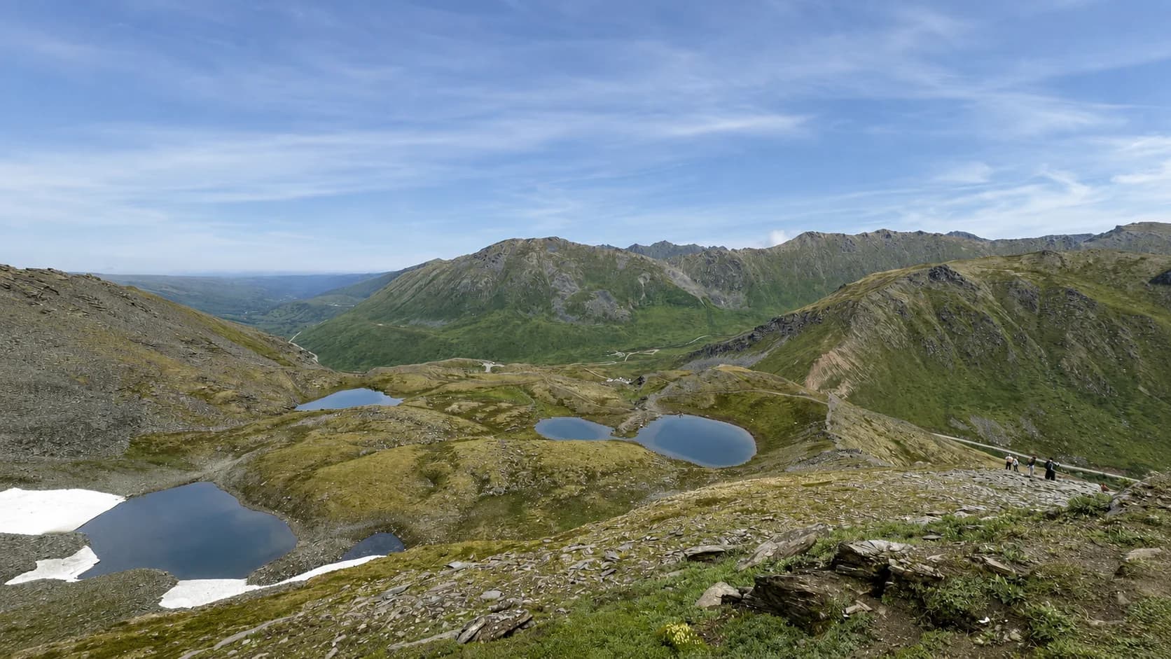
April Bowl is the hike to pick when you want Hatcher Pass to include real time on foot, not just scenic stops. From the Summit Lake trailhead, switchbacks climb into a small valley holding a cirque lake and several smaller ponds, then the trail turns into a ridge route that the state park's own trail description calls extremely narrow and rough, ending at Hatch Peak. It's a genuine hike, not a stroll — a different commitment than Summit Lake's easy loop nearby.
Who this suits
Hiking, alpine scenery, and photography for travelers who want to get out onto the terrain rather than view it from a pullout. Best for active travelers already planning a Hatcher Pass day. For an easier stop at the same trailhead, see Summit Lake instead.
A plan that works
- Make this the main physical activity of the Hatcher Pass day rather than stacking it with another full hike.
- Summit Lake or Independence Mine both pair naturally afterward, depending on time and how the group is feeling.
- The official round trip is about 2.2 miles with roughly 800 feet of elevation gain — real numbers, but check current trail and weather conditions before you go, not just the stated distance.
- The switchback section into the small valley and its ponds is the more moderate part; the ridge section beyond is genuinely narrow and rough — know which part of the hike you're signing up for.
Plan your visit
Drive and timing, honestly
- The trailhead is at the same general area as Summit Lake, near the top of Hatcher Pass Road — access depends on the upper road being open for the season.
- Conditions at this elevation can differ sharply from Wasilla or Palmer — check current weather at the pass itself, not just the Valley forecast.
- No drive time is stated from either property — none has been measured. Plan the drive up plus the hike as one Hatcher Pass day.
What we won’t promise
- We would not call this an easy hike — the ridge section is genuinely narrow and rough by the state park's own description.
- We cannot promise trail, snow, or mud conditions — they vary through the season and after weather.
- We cannot promise clear mountain views. Weather and visibility change quickly at this elevation.
- We cannot promise the upper Hatcher Pass road is open on your dates — access is seasonal.
Practical notes
- Official figures: about 2.2 miles round trip, roughly 800 feet of elevation gain, starting with switchbacks and ending at Hatch Peak.
- Pack real hiking layers and footwear — exposed alpine terrain, and the ridge section is narrow underfoot.
- Shares its trailhead area with Summit Lake, so the two are easy to combine or choose between on the same day.
Local context
Around Hatcher Pass
Where April Bowl sits within Hatcher Pass — open any of the mapped places directly, or explore more of the area below.
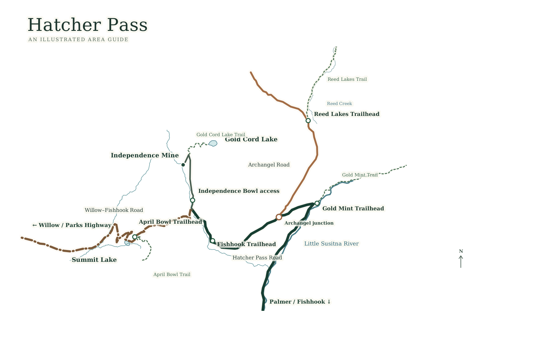
Choose a place to view on the map
Explore Hatcher Pass experiences
- Reed Lakes Trailstrenuous · Flexible: one hour to a full day
- Summit Lake at Hatcher Passeasy · A short, easy stop within a Hatcher Pass day
- April Bowlmoderate · A few hours · a real hike, not a casual stop
- Skeetawk Ski AreaFlexible · a winter ski stop or a summer café/trail stop
- Gold Cord Lakemoderate · 1 to 2 hours · short alpine payoff
- Gold Mint Trailstrenuous · Flexible · any point is a legitimate turnaround